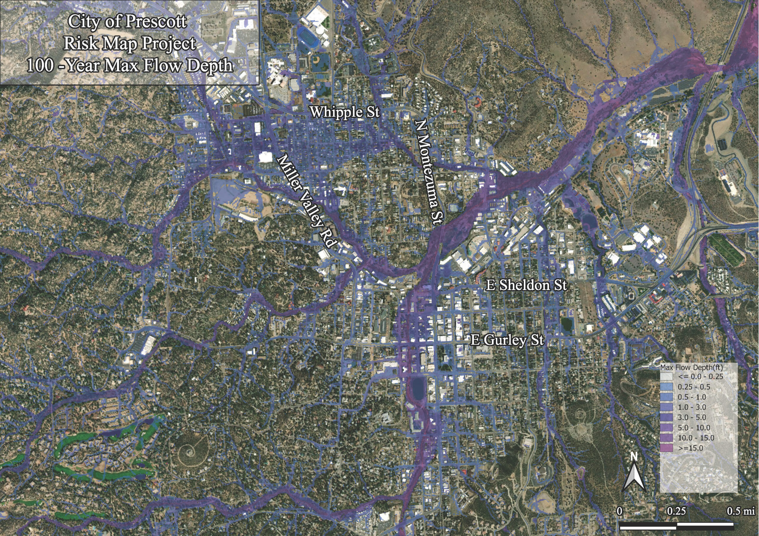
City of Prescott Risk MAP and Floodplain Map
Wilson & Company was contracted by the City of Prescott, Arizona, to work on their floodplain mapping update. The project included:
- Project management
- Field survey and new LiDAR QC
- Development of regulatory, detailed (1- and 2-D) hydrologic and hydraulic models
- Nine (9) linear miles of Zone AE floodplain/floodway remapping through the center area
- Development of non-regulatory products
- Coordination with stakeholders and FEMA RIX
- FEMA MIP maintenance
Wilson & Company provided submittals to FEMA via the MIP, with floodplain remapping submitted to FEMA as a LOMR. Two-dimensional H&H analyses were performed for total City limits and contributing areas. A detailed HEC-RAS modeling was conducted in Zone AE floodplain and floodway delineations.
Hydrology submitted to FEMA was conducted using a 2-D modeling approach to best capture the complex timing of numerous tributary flood waves conveyed through the urban area and concentrated within Granite Creek – the primary stream corridor through the city. However, the 2-D modeling results (discharges) were used as input for HEC-RAS (1-D) modeling of subject streams to address potential regulatory floodway delineation issues.

