-
 Wilson & Company was contracted to perform aerial and mobile mapping for this 20-mile roadway in support of survey and design.
 -
Aerial imagery was captured for photogrammetric mapping and orthophotography, while airborne lidar was acquired for topography outside the roadway.
-
Mobile lidar was collected on K-10 and crossing roadways to develop high-accuracy surface modeling.
-
Planimetric compilation, lidar topography, orthophotography, and field survey data were integrated.
K-10 Geospatial
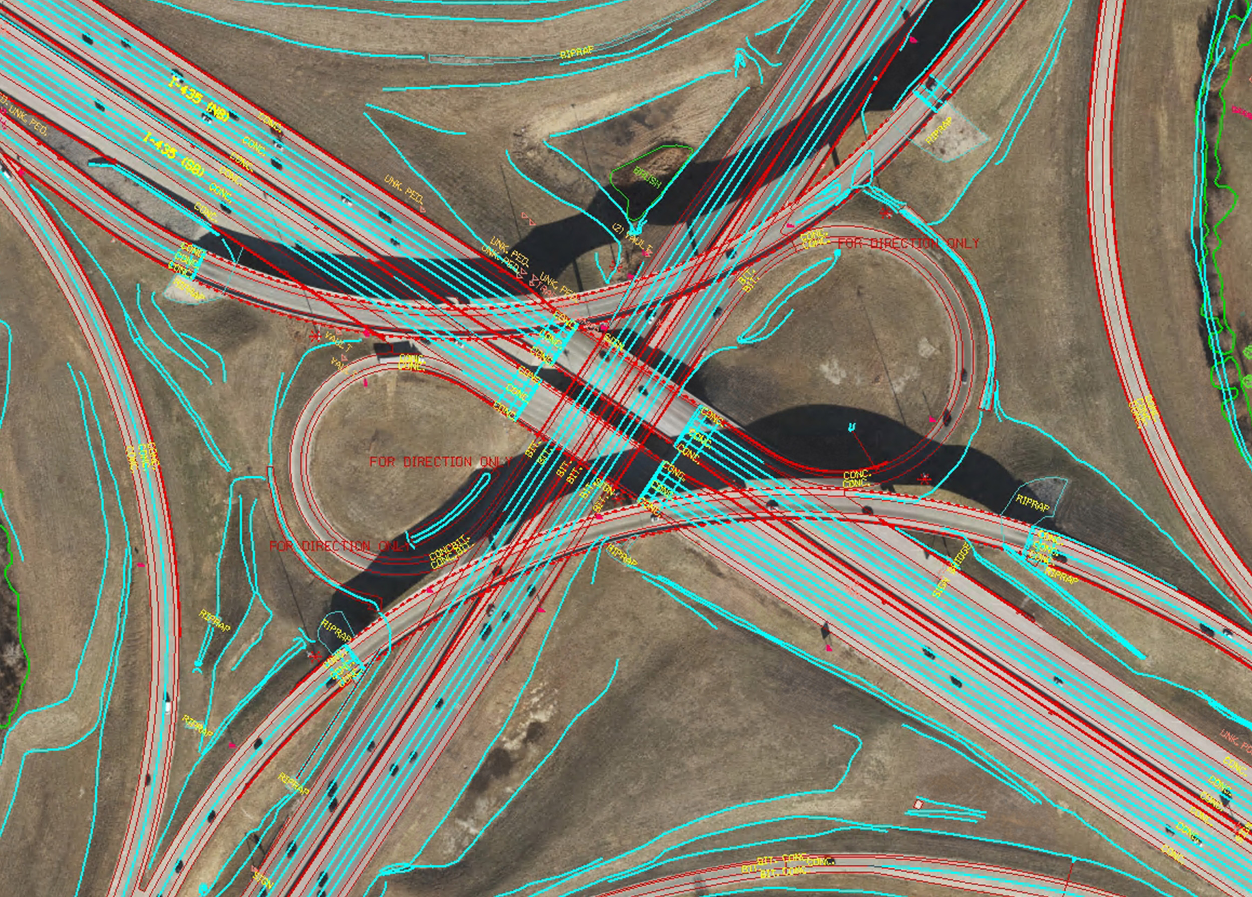
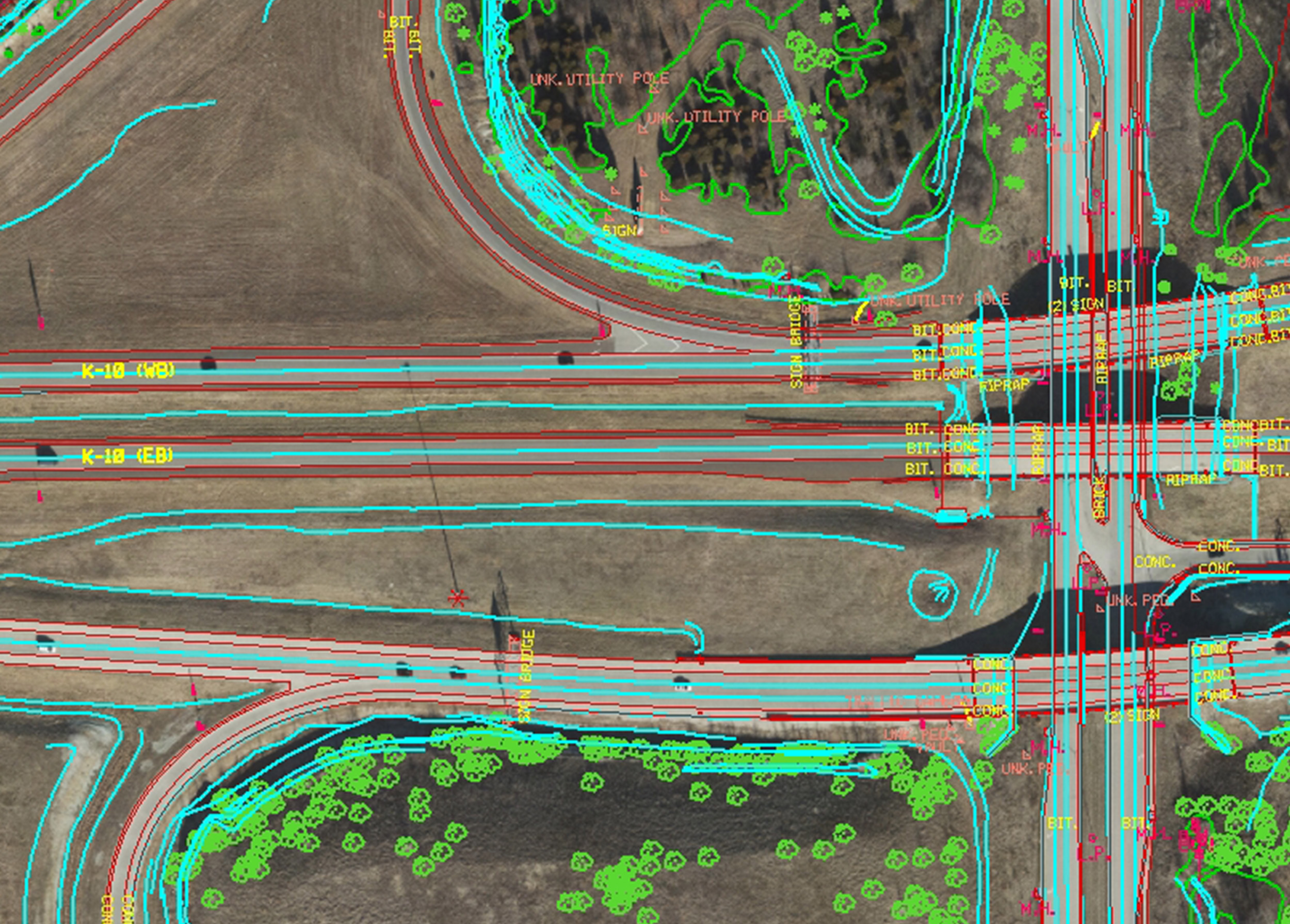
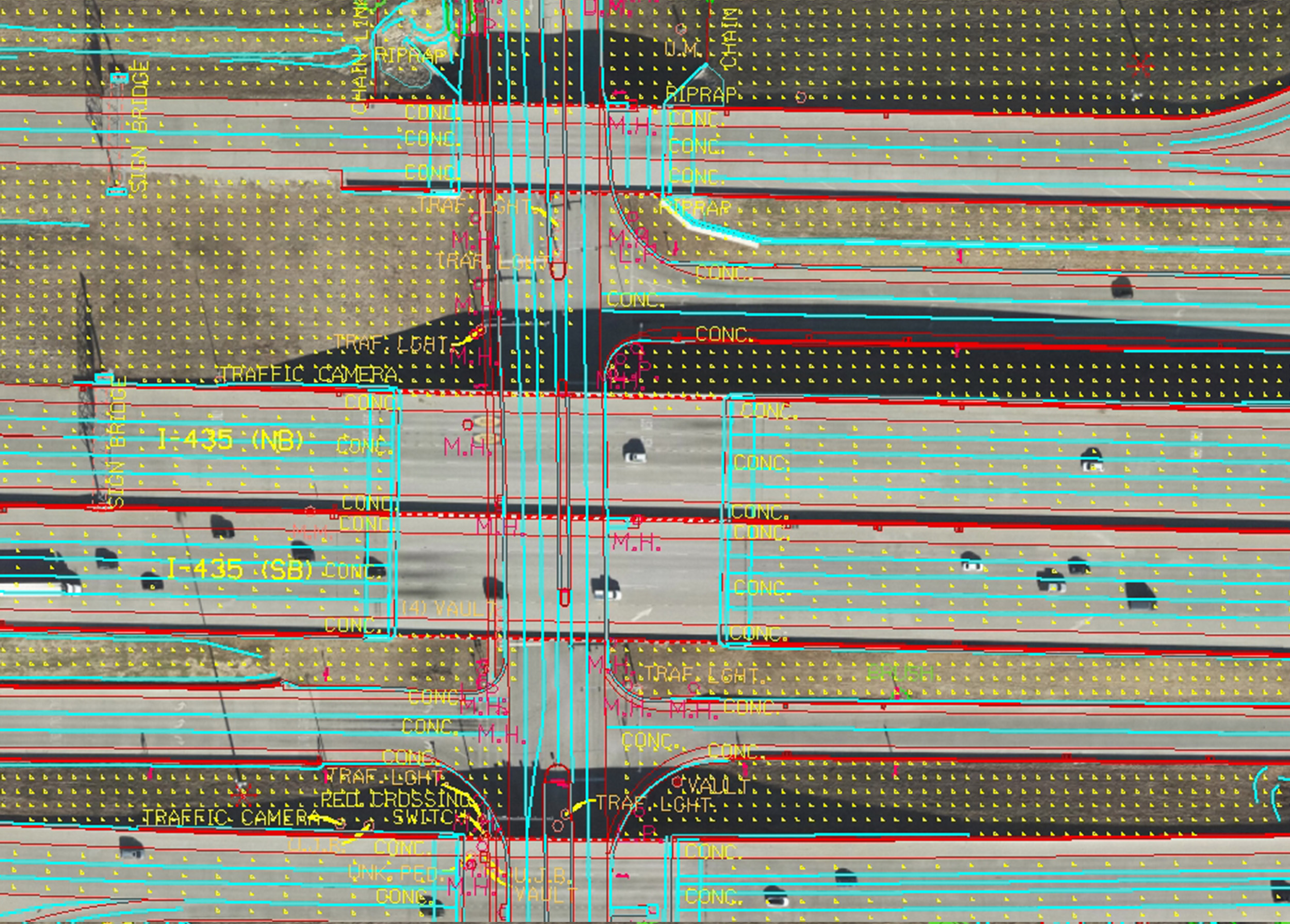
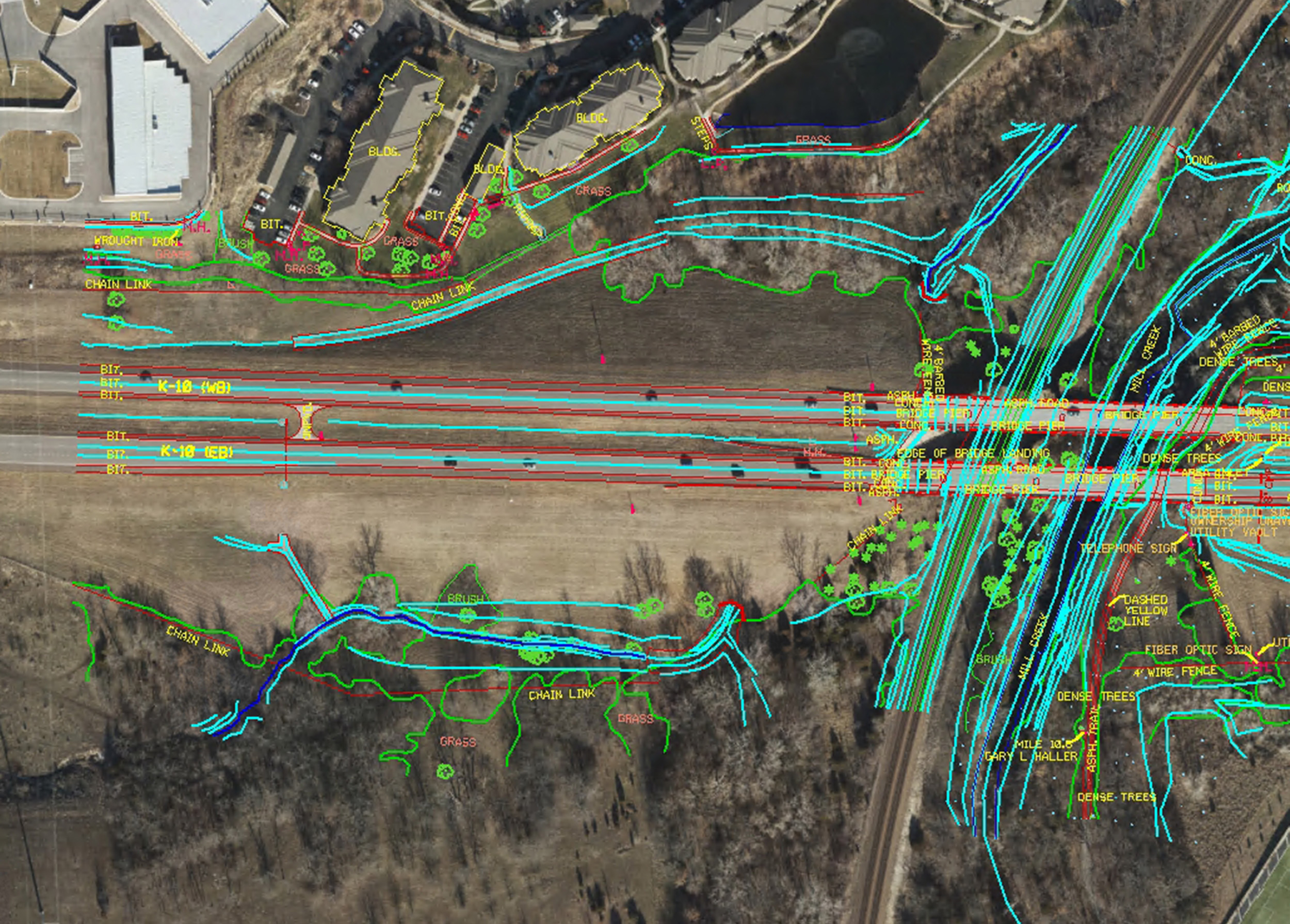
With the expanding population and commerce in Johnson County, KS, capacity improvements were required along the K-10 roadway corridor between Eudora, KS, and I-435. With vast experience in topographic mapping and integration, Wilson & Company was contracted to perform aerial and mobile mapping for this 20-mile roadway in support of survey and design. Aerial imagery was captured for photogrammetric mapping and orthophotography, while airborne lidar was acquired for topography outside the roadway. Mobile lidar was collected on K-10 and crossing roadways to develop high-accuracy surface modeling. Planimetric compilation, lidar topography, orthophotography, and field survey data were integrated into comprehensive CADD deliverables to Kansas Department of Transportation (KDOT) specification.